Mekong Sailing - Visualisation
Using old Mekong maps to buil a personal project for a scroll based map visualization system.
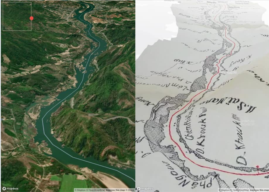
This personal project is a web map visualization based on the first version of the Siam-Lao border from this website.
The project started with QGIS for georeferencing maps drawn on many pages of a book.
Then, I set up a tile server using Mapbox Studio to serve the maps.
Finally, I tested 3 different ways to visualize these maps along the Mekong River using: auto scroll, manual scroll, and manual scroll with 2 maps side by side.
This visualization system is intended to be a base for future geostories.
Made with QGIS, Mapbox Studio, Vue, and Mapbox GL.
Achievements
-
GIS:
Georeferencing of old map images and serving from Mapbox Studio.

-
Web Development:
Development of a creative visualisation system for geostories using Vue and Mapbox.
